The University of Washington has a detailed online topography database that shows both land topography and underwater bathymetry of the Puget Sound area. The visual representations of the data are interesting since they strip away trees, structures, and fields, and provide a light-shaded representation of land and water as if it were bald.
I honed in on the Coupeville area, and this is what I found. The property is located just southwest of Long Point in this picture.
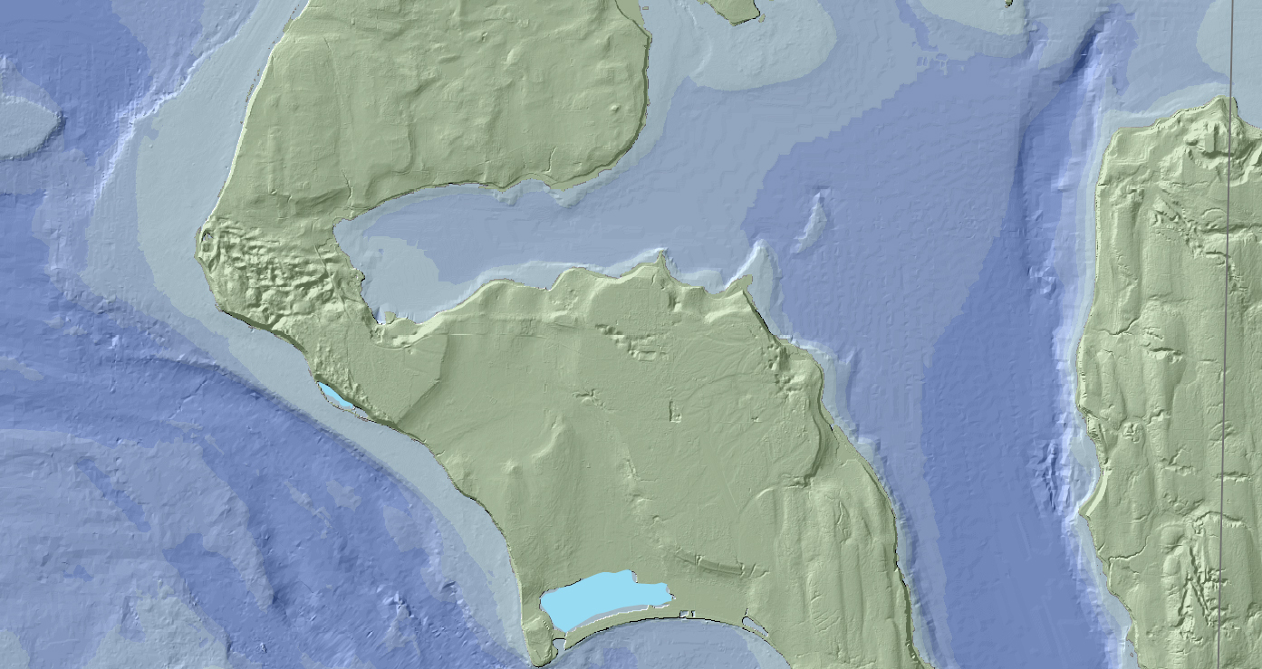
Coupeville topography and Penn Cove bathymetry